|
Germany
Travel Guide
Thüringen Travel Information
The Free State of Thuringia
(German: Freistaat Thüringen) is located in central Germany.
It has an area of 16,171
square kilometers (6,243.7 sq mi) and 2.29 million inhabitants, making it
the sixth smallest by area and the fifth smallest by population of
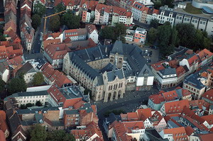
Germany's sixteen Bundesländer (federal states). The capital is Erfurt.
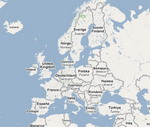
 Thuringia
borders on (from the northwest and clockwise) the German states of Lower Saxony,
Saxony-Anhalt, Saxony, Bavaria and Hesse. The ridges of the
western Harz Mountains divide the region from Lower Saxony on the
north-west, while the eastern Harz similarly separates Thuringia from the
state of Saxony-Anhalt to the north-east. To the south and southwest, the
Thuringian Forest effectively separates the ancient region of Franconia,
now the northern part of Bavaria, from the rolling plains of most of
Thuringia. The central Harz range extends southwards along the western
side into the northwest corner of the Thuringian Forest region, making
Thuringia a lowland basin of rolling plains nearly surrounded by ancient
somewhat-difficult mountains. To the west across the mountains and south
is the drainage basin of the Rhine River. Thuringia
borders on (from the northwest and clockwise) the German states of Lower Saxony,
Saxony-Anhalt, Saxony, Bavaria and Hesse. The ridges of the
western Harz Mountains divide the region from Lower Saxony on the
north-west, while the eastern Harz similarly separates Thuringia from the
state of Saxony-Anhalt to the north-east. To the south and southwest, the
Thuringian Forest effectively separates the ancient region of Franconia,
now the northern part of Bavaria, from the rolling plains of most of
Thuringia. The central Harz range extends southwards along the western
side into the northwest corner of the Thuringian Forest region, making
Thuringia a lowland basin of rolling plains nearly surrounded by ancient
somewhat-difficult mountains. To the west across the mountains and south
is the drainage basin of the Rhine River.
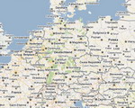
The
most conspicuous geographical feature of Thuringia is the Thuringian
Forest, a mountain chain in the southwest. The Werra River, a tributary
of the Weser River, separates this mountain chain from the volcanic Rhön
Mountains, which are partially in Thuringia, Bavaria, and Hesse. In the northwest,
Thuringia includes a small part of the Harz. The eastern part of
Thuringia is generally a plain. The Saale River runs through these
lowlands from south to north.
The
geographic center of the Federal Republic is located in Thuringia, near
the municipality of Niederdorla.
read more
|